
The Joshua Tree National Park is a 1-hour drive east of Palm Springs in Southern California.
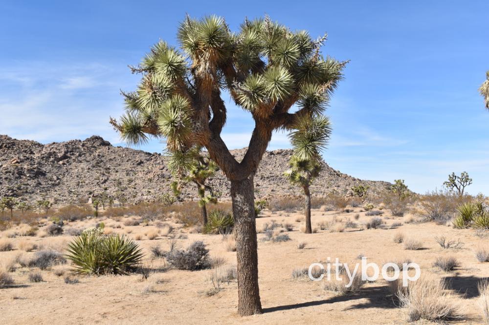
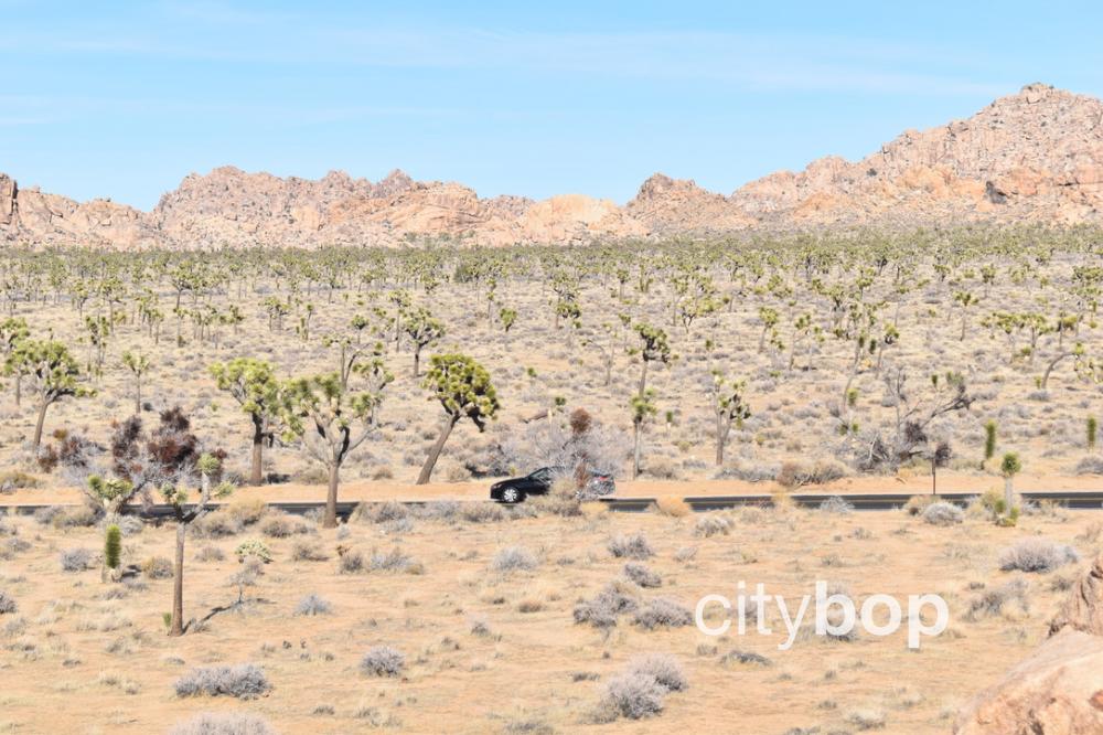
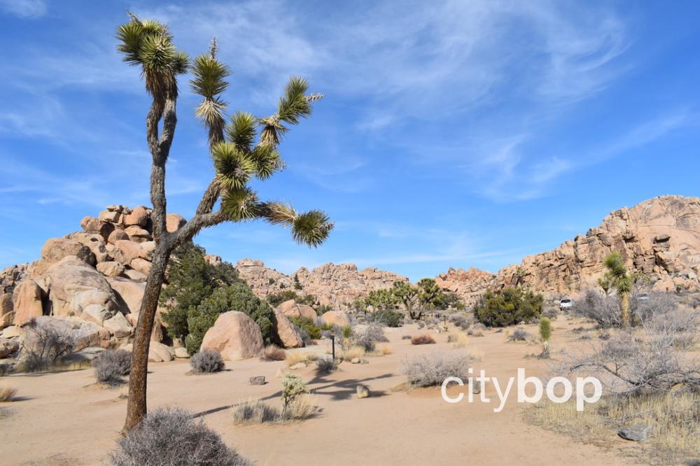
This 800,000-acre park was established in 1994, and includes both the Mojave and Colorado deserts. It’s famous for its wide-open desert landscapes, giant rock formations, and otherworldly Joshua Trees.
The Joshua Trees can only be found in the Mojave Desert, on the northern and western side. The southern and eastern side of the park is in the Colorado Desert, and at a 3,000 foot lower elevation is much drier.
Admission fees can be paid at the North, West or South entrance booths, and there are visitor centers before each of these entrances.
The main road running through Joshua Tree National Park is Park Boulevard, with many well-signed hikes and attractions accessible from this road.
There is no fresh water, food or lodging inside Joshua Tree National Park, however there are plenty of camping grounds, picnic tables, grills and vault toilets accessible off Park Boulevard.
Tips
- Months to visit: The best time to visit Joshua Tree National Park is in spring or fall. It gets most crowded during spring break, and any weekend between October to May. Winter nights are freezing.
- Bring: Always bring the ten essentials (water, food, clothing layers, sunscreen, first aid kit, navigation, pocket knife, flashlight, emergency shelter, sturdy shoes).
- Cellphone: There is spotty cellphone reception, so pick up a map.
- Campsites: Reserve campsites in advance.
3 Main Visitor Centers
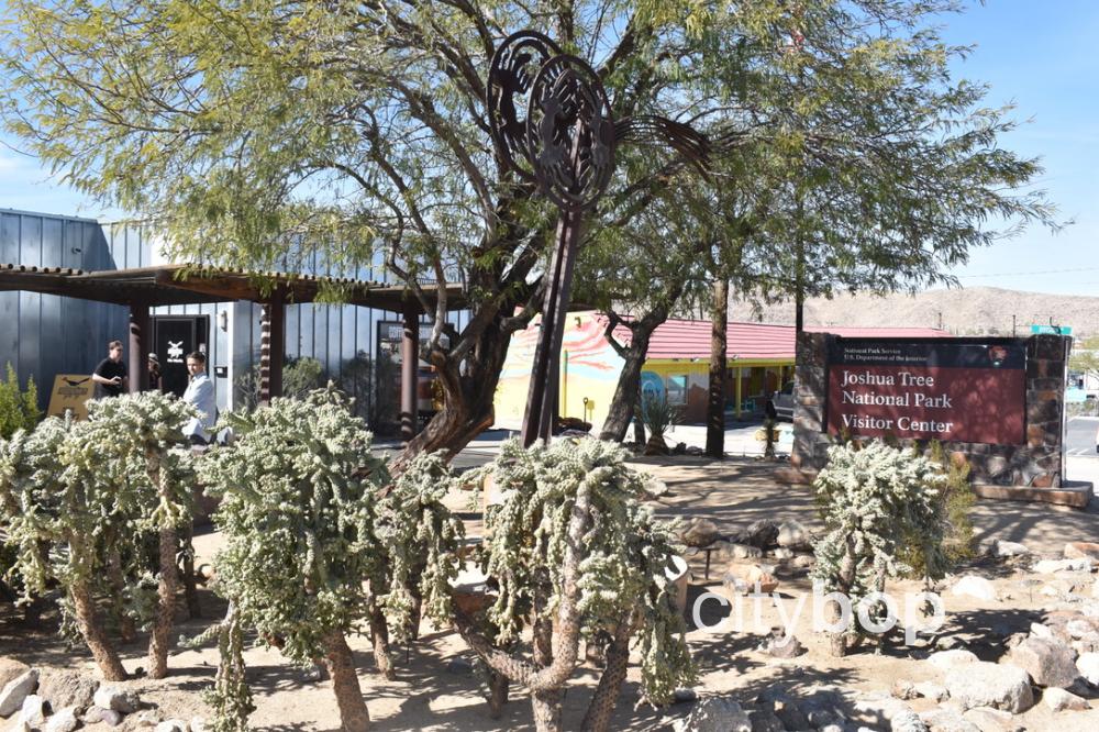
- Joshua Tree Visitor Center: Downtown Joshua Tree, before the West Entrance.
- Joshua Tree National Park Visitor Center: Downtown Twentynine Palms, before the North Entrance.
- Cottonwood Visitor Center: Pinto Basin Road, before the South Entrance.
8 best stops at Joshua Tree National Park
This 26-mile route travels along Park Boulevard and has 8 stops. It starts at Joshua Tree Visitor Center, and ends at Split Rock.
1. JOSHUA TREE VISITOR CENTER
This visitor center is located at the West Entrance, and has park passes, hiking maps, camping permits, books, and park rangers on hand to answer questions. There’s also a shop next door with refreshments.

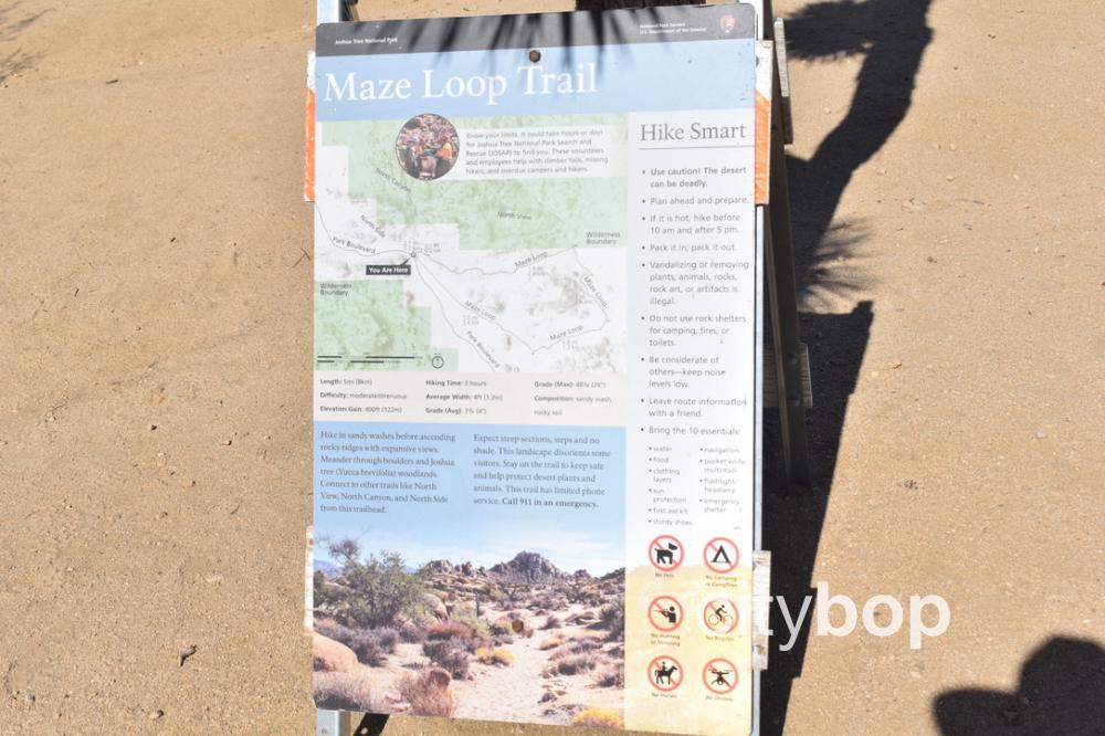
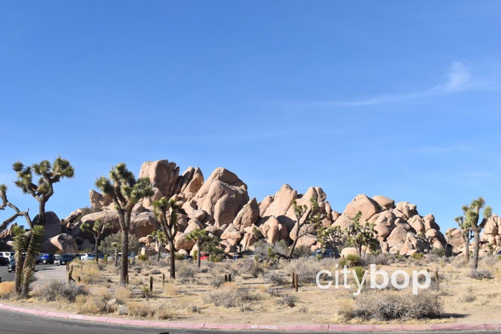
2. MAZE LOOP TRAIL (5-mile loop)
This moderate to strenuous hiking trail has an elevation gain of 400-feet, with lots of steps and steep inclines. It passes through gigantic boulder pile, Joshua Tree woodland, and along ridges.
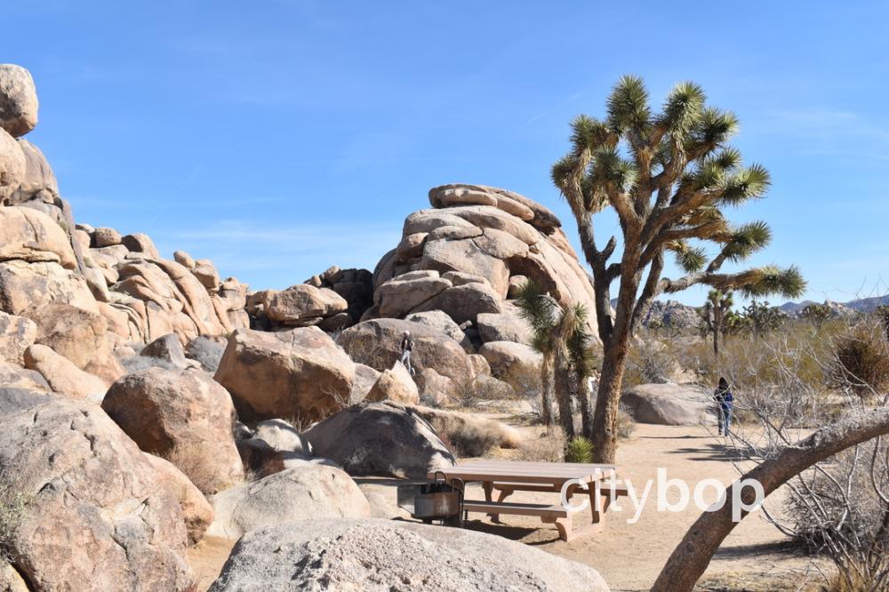
3. QUAIL SPRINGS PICNIC AREA
This picnic area is just off Park Boulevard, with picnic tables, grills and pit toilets. Wander through the boulders behind the picnic tables for expansive views.
4. HEMINGWAY BUTTRESS PULL-OFF
This roadside pull-off has incredible views of Hemingway Buttress, favored by professional climbers. There are pit toilets and a small parking lot.
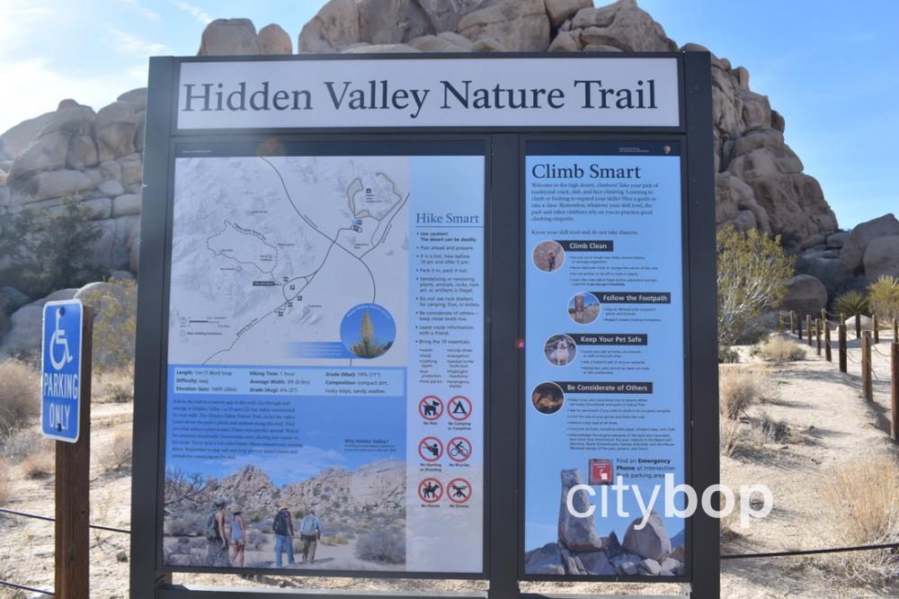
5. HIDDEN VALLEY NATURE TRAIL (1-mile loop)
A large parking lot leads to an easy trail with 100-feet elevation gain. Follow the trail a short distance up-hill, for panoramic views of the 55-acre Nature Valley. Complete the loop around the valley and return back. There are picnic tables with grills and vault toilets at the parking lot.
6. CAP ROCK TRAIL (0.4 mile loop)
Cap Rock can be viewed from the parking lot, with a picnic area nearby with grills. You can also take a flat, easy, 0.4-mile loop trail.
.jpg)
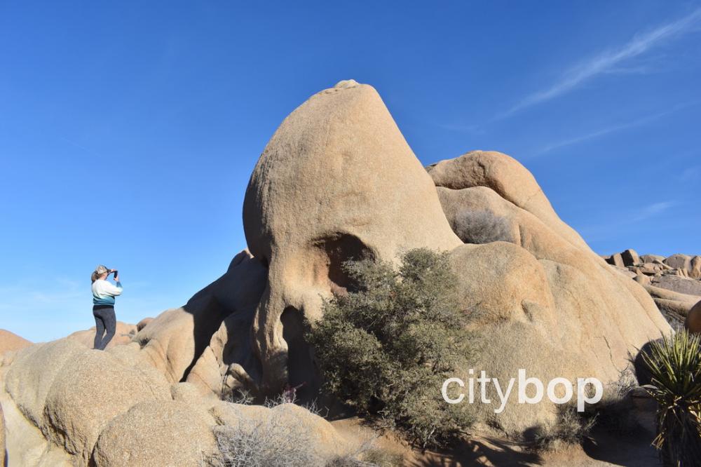
7. SKULL ROCK
This roadside attraction along Park Boulevard is extremely popular, with hollowed out eye sockets in a giant boulder.
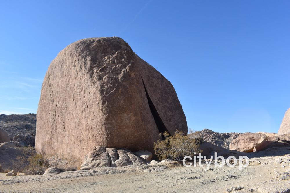
8. SPLIT ROCK LOOP TRAIL (2.5 mile loop).
This moderate hike has an 150 feet elevation gain, with both jumbo rocks and open desert terrain. You can see Split Rock at the trailhead, just near the picnic area.
.jpg)


Review this attraction