
Drive into the amazing blast zone from the Mt Saint Helens eruption in 1980.
Mt Saint Helens is an active volcano near the Washington and Oregon border, 1-hour north of Portland, and 2-hours south of Seattle. The last major eruption at Mt Saint Helens was on the morning of May 18, 1980.
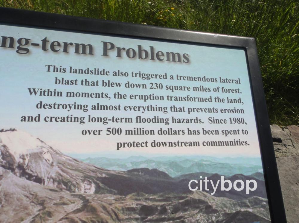
The blast caused the north face of Mt Saint Helens to collapse, and created the largest landslide on record. Debris raced down the mountain at speeds of 80-miles per hour and destroyed everything in its path, killing 57 people. Day turned to night as the landscape was enveloped in a thick black cloud that emanated intense heat, and unleashed hurricane force winds that uprooted 230 square miles of forest.
Scenic drive to Mt Saint Helens
Take the scenic 51-mile drive along Route 504 off Interstate-5, that ends at the Johnson Ridge Observatory. Check winter road closures and road conditions along Mt Saint Helens West, before leaving. Here are the main stops:
- Milepost 19: Fire Mountain Grill
- Milepost 33: Forest Learning Center (check hours, summer only).
- Milepost 37: Elk Rock Viewpoint
- Milepost 40: Castle Lake Viewpoint
- Milepost 43: Coldwater Lake Visitor Center (check hours, summer only).
- Milepost 45: Coldwater Lake access: closed due to landslide
- Milepost 50: Loowit Viewpoint - closed due to landslide
- Milepost 51: Johnson Ridge Observatory - closed due to landslide
**The final section of the road is is currently closed from milepost 43 to 51, due to May 2023 landslide**
Lodging & restaurants
There are limited lodging options along Route 504 but these include the Blue Heron Chateau B&B, and the Eco Park Resort with rustic cabins, RV hook-ups, camping, yurts, a café and gift shop. The only restaurants are the Fire Mountain Grill, and Backwoods Cafe.
10 best things to see at Mt Saint Helens.
Drive 51-miles along Route 504 to Mt Saint Helens, ending at the Johnson Ridge Observatory. Check road conditions before leaving.
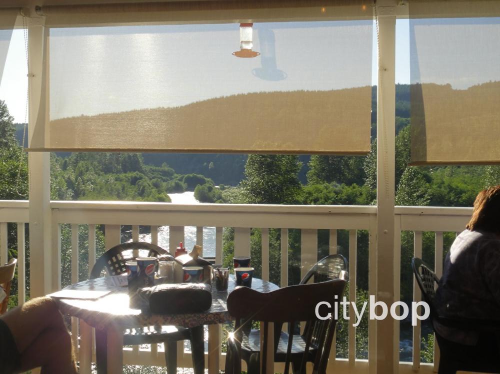
1. Stop for a meal at the Fire Mountain Grill (milepost 19).
Take Route 504 to Mt Saint Helens off Interstate 5, then drive 19-miles until you reach the Fire Mountain Grill.
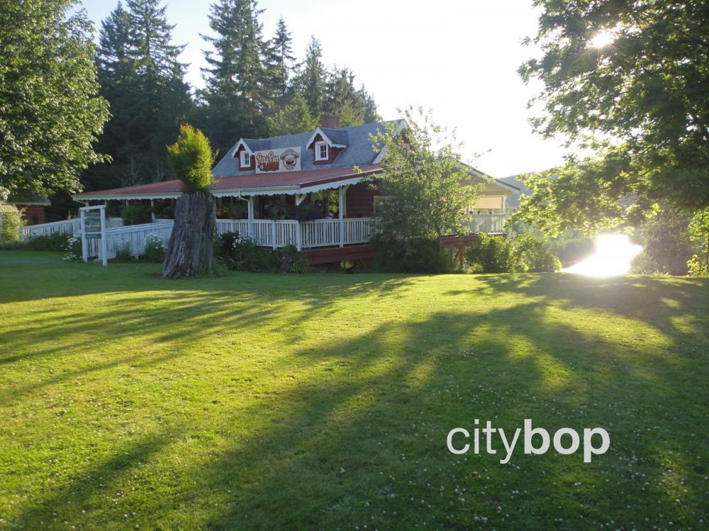
There are superb views of Toutle River from a cliff-side patio.
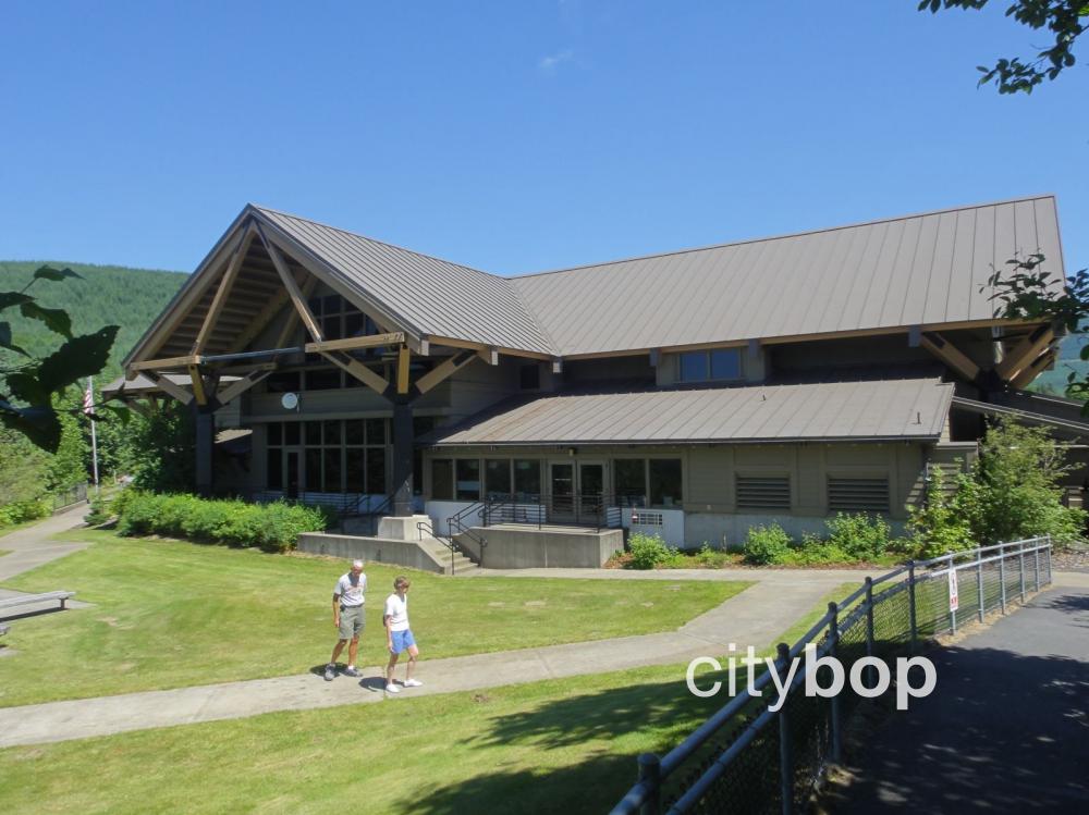
2. Visit the free Forest Learning Center (milepost 33).
The Forest Learning Center (milepost 33) is next, open from mid-May thru early September. It offers free exhibits and a captivating film with awe inspiring original footage from the Mt Saint Helens eruption. You can also stop by the gift shop.
Step inside the Forest Learning Center located within the blast zone.
.jpg)
The Forest Learning Center has a fascinating movie on the Mt Saint Helens eruption, and the long road to recovery and re-forestation undertaken by the Weyerhaeuser logging company.
There's so much hands on fun here! Kids will love the interactive area, and the slides and climbing equipment at the outdoor nature playground.
.JPG)
This really cool model shows the full extent of the blast zone.
Any forest within 6 miles of the volcano was in the Tree Removal Zone, where trees were completely uprooted and tossed about like match sticks in the hurricane force winds. The Tree Blow Down Zone was 6 to 14 miles, where bark and branches were stripped clean from trees in searing 600 degree fahrenheit heat.

You can also do a virtual Mt Saint Helens tour in a helicopter, and survey all the destruction from above.
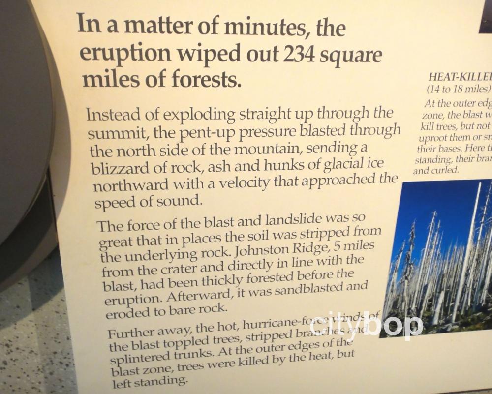
The Mt St Helens eruption generated hurricane force winds in the blast zone, that stripped heavily forested hills back to rock. Approximately 234 square miles of forest was wiped out.
3. Step outside the Forest Learning Center to explore the trails overlooking the Toutle River.
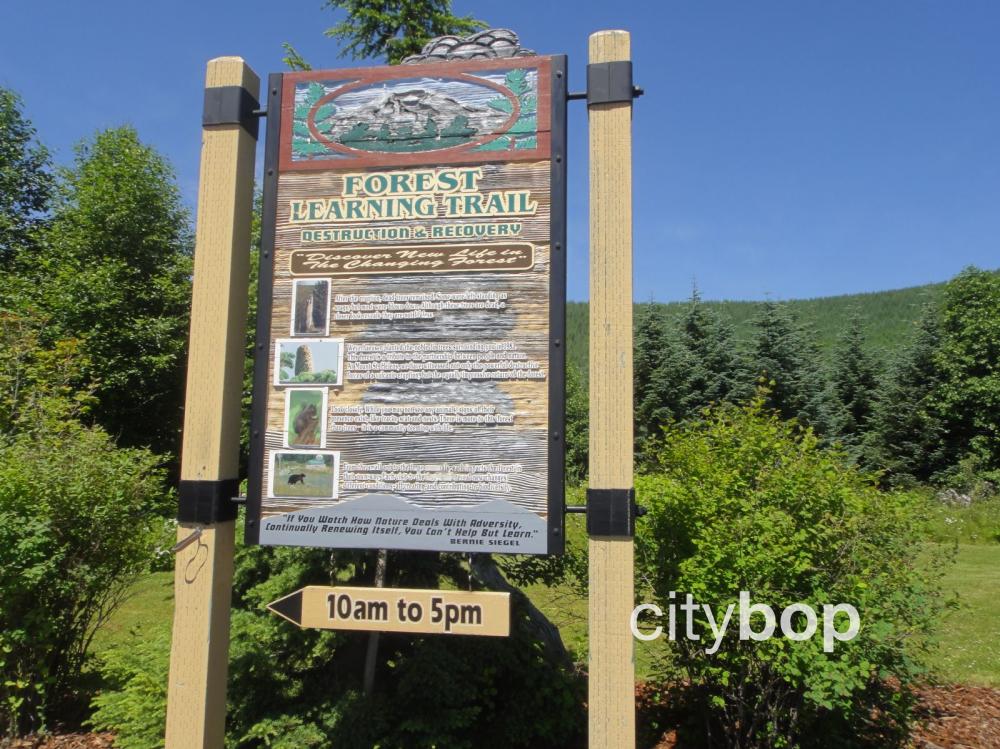
Here's a sign leading to the trails outside the Forest Learning Center.
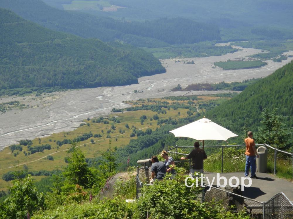
The viewing platform outside the Forest Learning Center provides a bird's eye view of the reformed channel carved by the Toutle River after the eruption. If you're lucky, you might even spot a few elk.
The north fork of the Toutle River was forever altered by the Mt Saint Helens eruption, causing an onslaught of violent mudslides that destroyed everything in their path. Logging camps, homes and downstream bridges were wiped out.
The excitement builds as you can see distant views of snowcapped Mt St Helens. Don't worry, you'll soon be getting even closer than this!
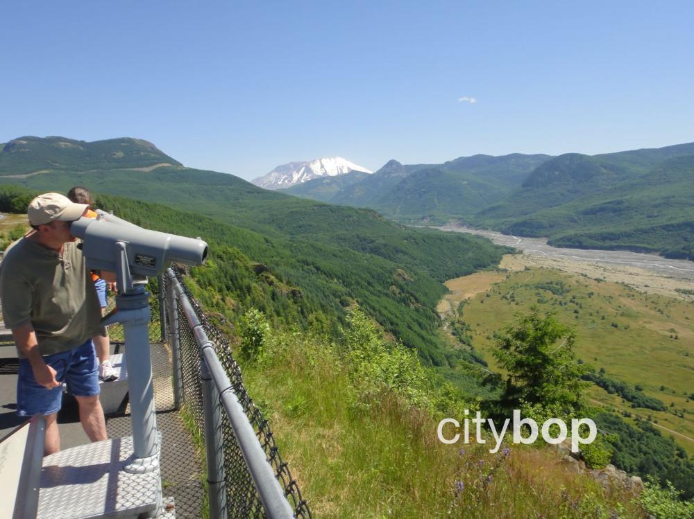
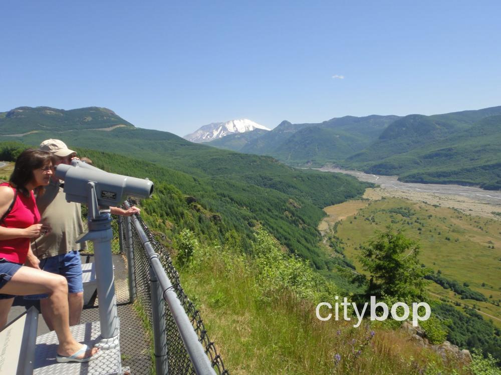
Peer through the telescopes for an even closer look at the valley floor.
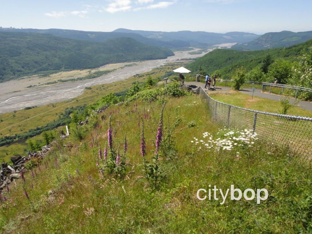
4. Stop at Elk Rock Viewpoint to see the blast zone (milepost 37)
The road becomes increasingly spectacular as you continue your ascent. At 3,800 feet you will reach Elk View Point, with expansive views of the stark blast zone around Mt St Helens. This marks the formal entrance to Mt St Helens National Volcanic Monument.
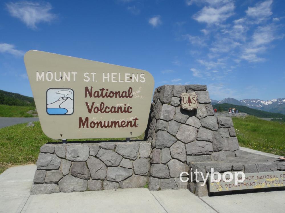
Here's the road sign at the Elk Rock Viewpoint to let you know you've arrived at the entrance to the Mt St Helens National Volcanic Monument.
.JPG)
Congress set aside 110,000 acres for this National Volcanic Monument, two years after the 1980 eruption.
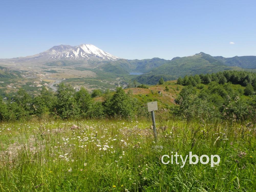
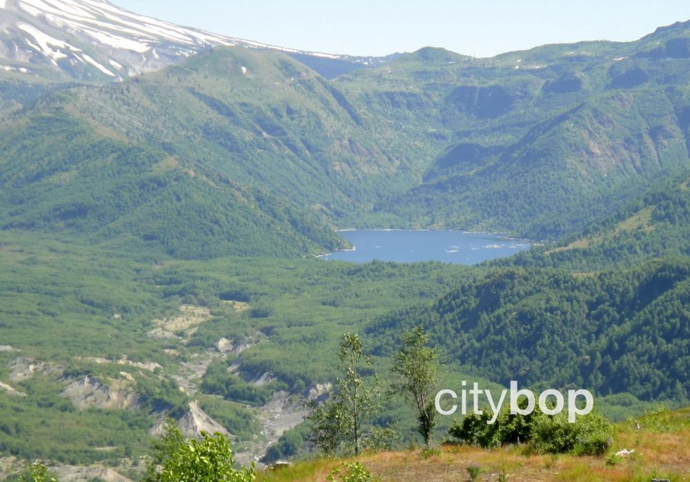
5. Stop at Castle Lake Viewpoint to see a new lake formed from the blast (milepost 40)
Castle Lake was formed on the day Mt Saint Helens erupted, after debris blocked the south fork of Castle Creek to create a natural dam.
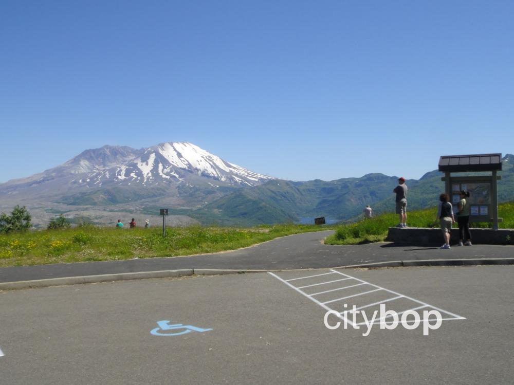
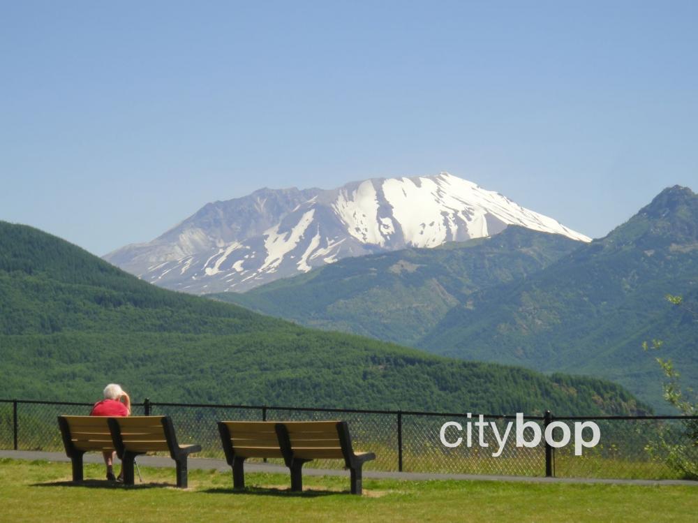
Can you see Castle Lake to the right of Mt Saint Helens?
It's amazing to think that Castle Lake was created from the 1980 eruption. In the winter of 1980/1981 after the eruption, the lake began to fill with water. There were concerns about flooding, so a new spillway was constructed In October 1981.
Castle Lake is extremely difficult to get to, and only for the most advanced hikers.
.JPG)
A wayside exhibit at the Castle Lake Viewpoint explains that there were plenty of warning signs that Mt Saint Helens would erupt. In the two months before the eruption, the mountain's north flank started bulging with magma, extending five feet every day!
6. Stop at the Coldwater Lake Visitor Center (milepost 43)
The Coldwater Lake Visitor Center is just a short distance from the highway (check hours, summer only).
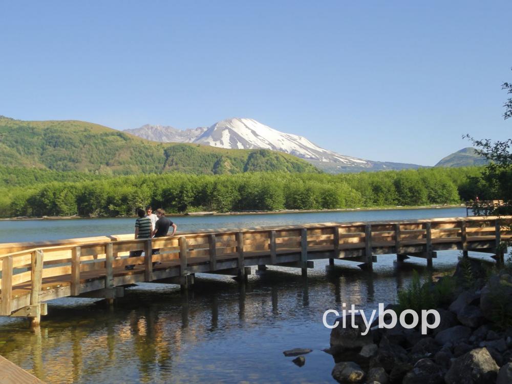
7. Stroll along Coldwater Lake (milepost 45) (closed due to landslide)
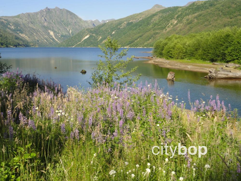
Visit Coldwater Lake, formed at the same time as Castle Lake on May 18, 1980.
If you visit the lake, don't forget to take your insect repellent. Those insects will bite!
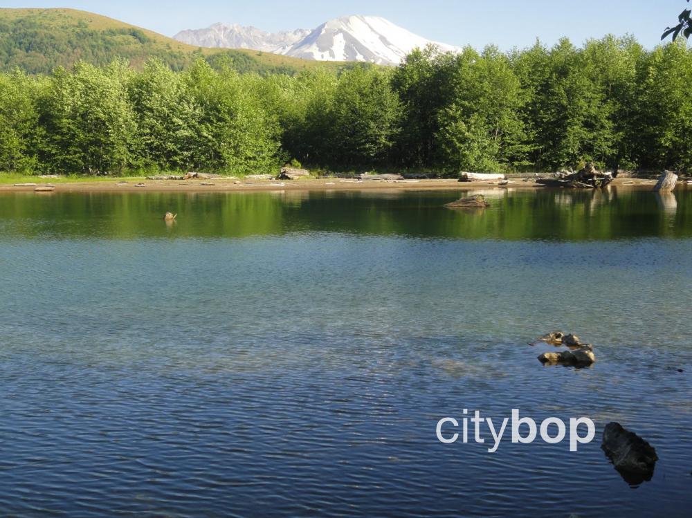
There are peep through views of Mt Saint Helens from Coldwater Lake.
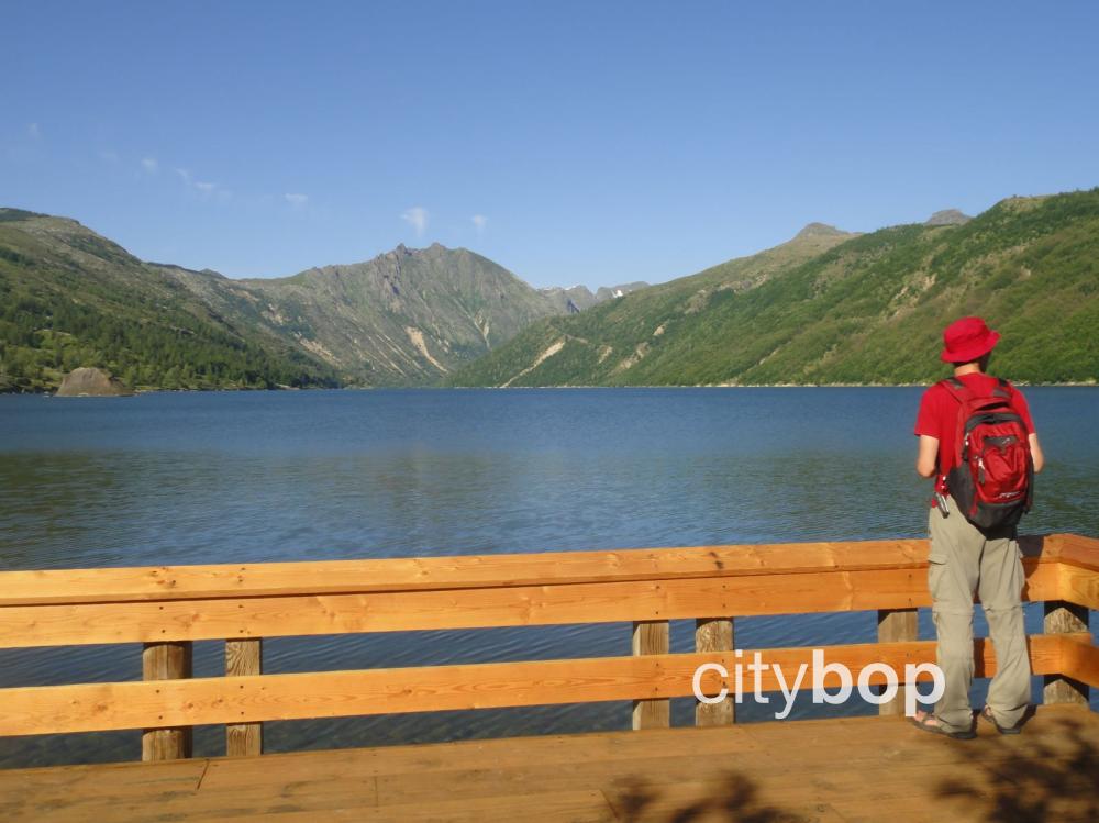
There's an easy ¼ mile walk along the lake with numerous viewing platforms and a boardwalk.
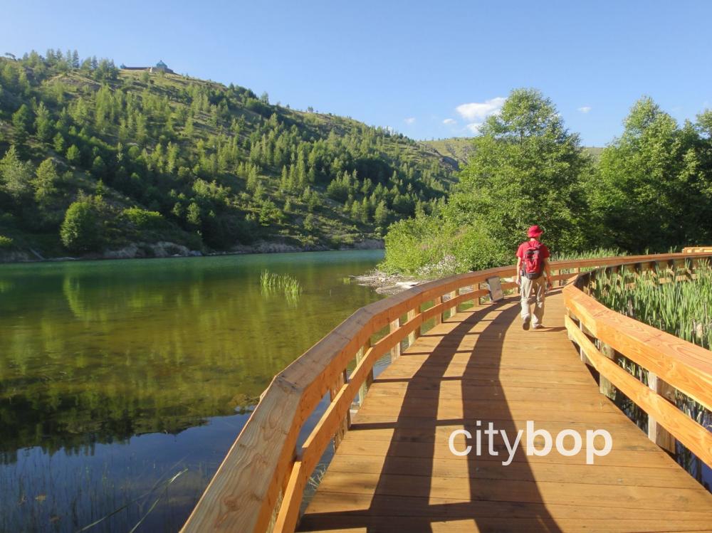
It's possible to see to the depths of the translucent waters of this lake.
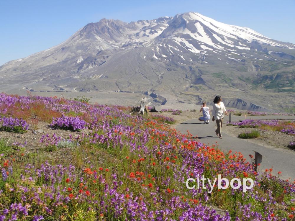
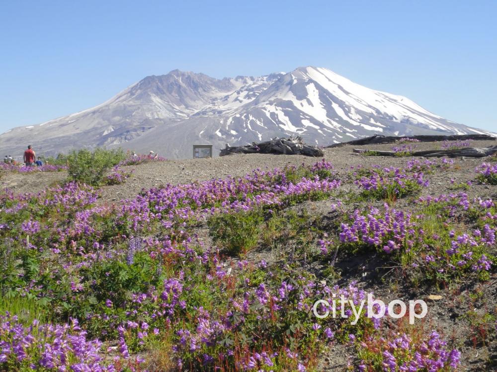
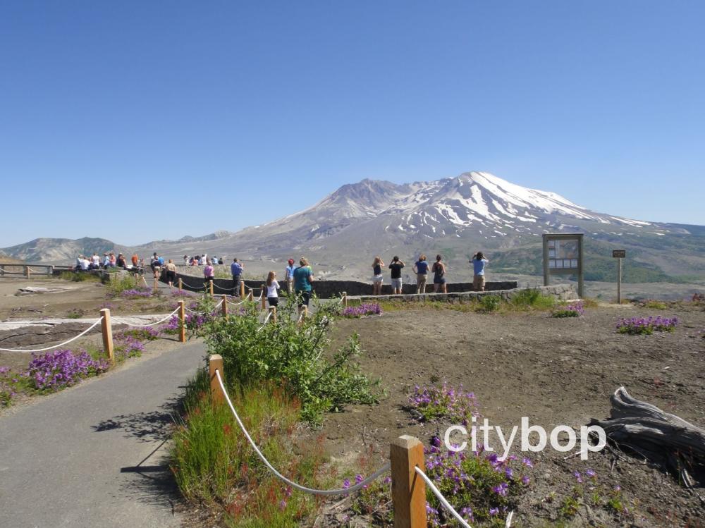
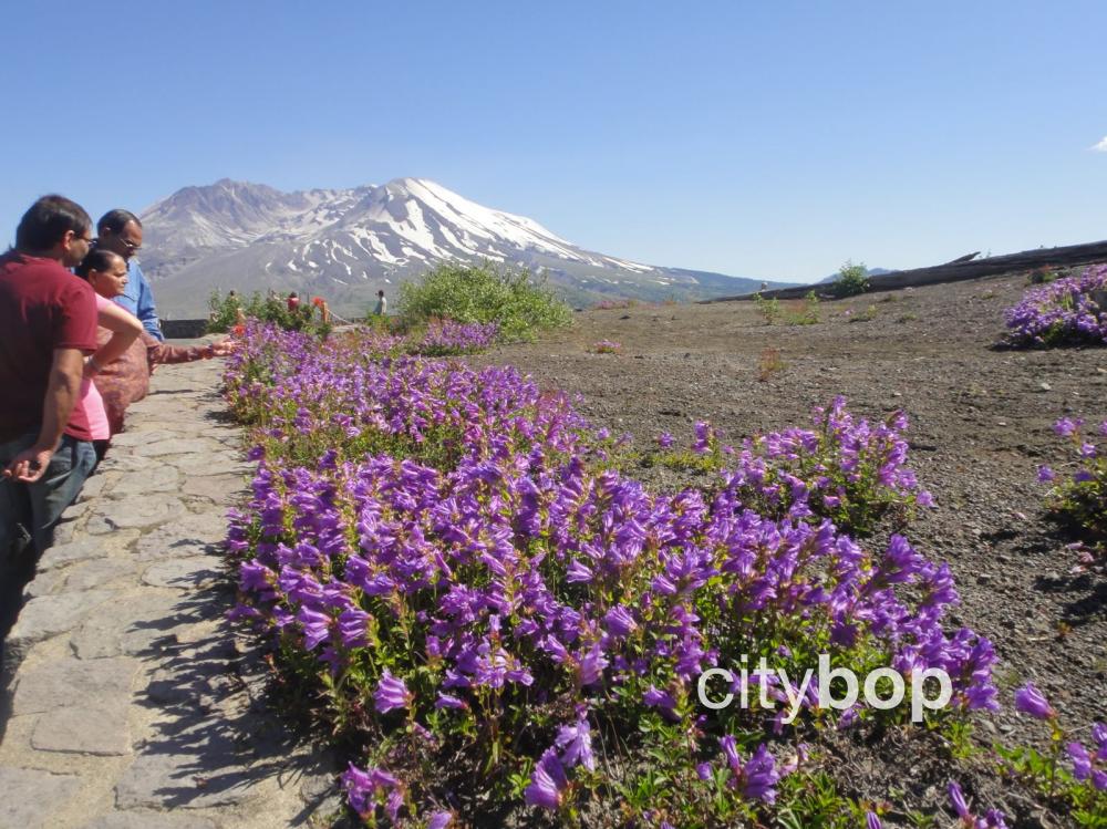
8. See gorgeous wildflowers at Loowit Viewpoint (milepost 50) (closed due to landslide)
Over the next few miles the road descends back down into the valley and travels along the river. It then commences another dramatic ascent to lovely Loowit Viewpoint, where the slopes are carpeted in a dazzling array of red and purple wildflowers in summertime.
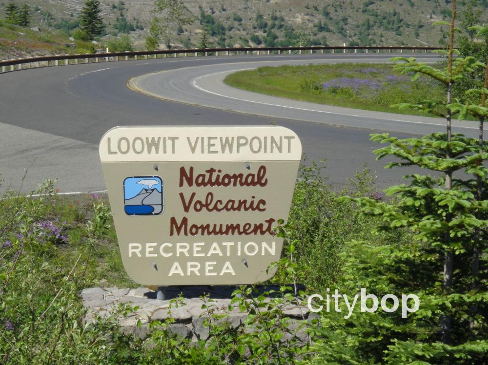
Here's the clearly marked sign to Loowit Viewpoint.
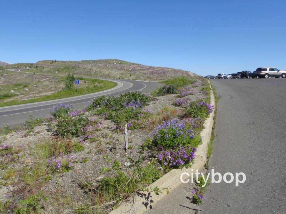
Pull into the large parking lot at Loowit Viewpoint.
Loowit Viewpoint provides a really close look at the damage from the 1980 eruption. The north face of the previously cone-shaped Mt Saint Helens was completely blasted out, causing a gigantic landslide and leaving the gaping crater you see today.
You would've been dead if you were standing in this exact spot on May 18, 1980!
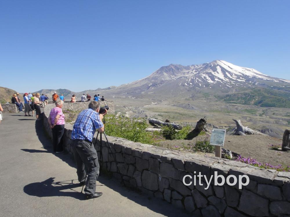
The views into the north face of Mt Saint Helens are incredible!
You can also follow some dirt trails near the viewpoint.
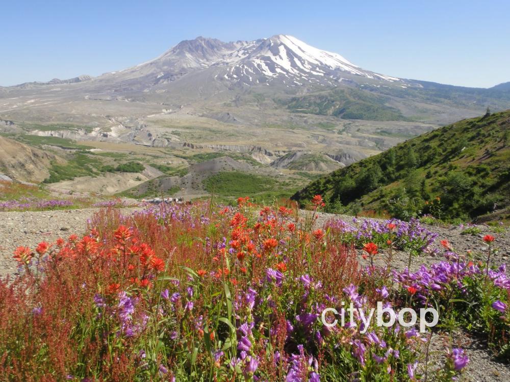
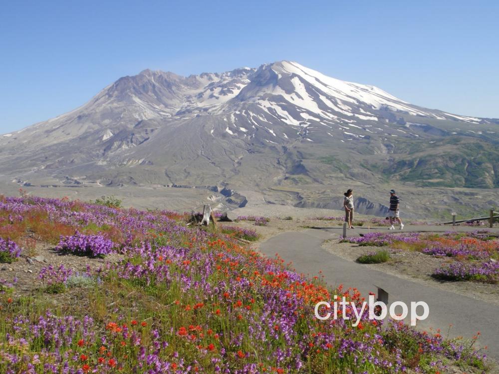
See gorgeous wildflowers, including purple turtleheads and scarlet paintbrush.
Dozens of plants and flowers have returned to the area devastated by the blast zone.
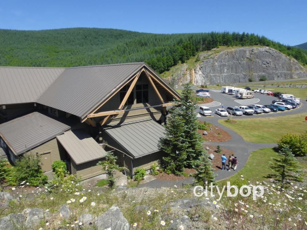
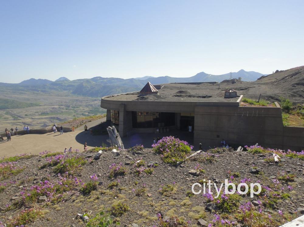
9. Watch the excellent movie at Johnson Ridge Observatory (milepost 51) (closed due to landslide)
The final stretch of the highway is to Johnson Ridge Observatory, open mid May to end September. For a small fee visitors can tour the exhibits, and view another excellent movie on the 1980 Mt St Helens eruption. The Johnson Ridge Observatory is built like a bunker into the side of the hill.
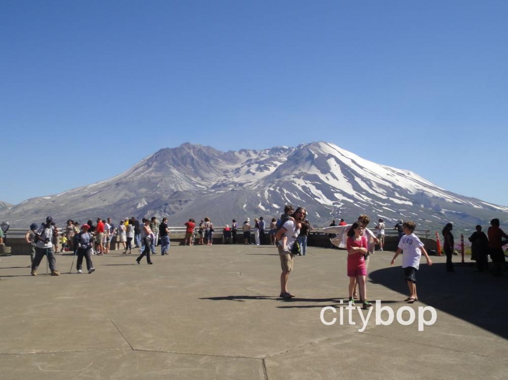
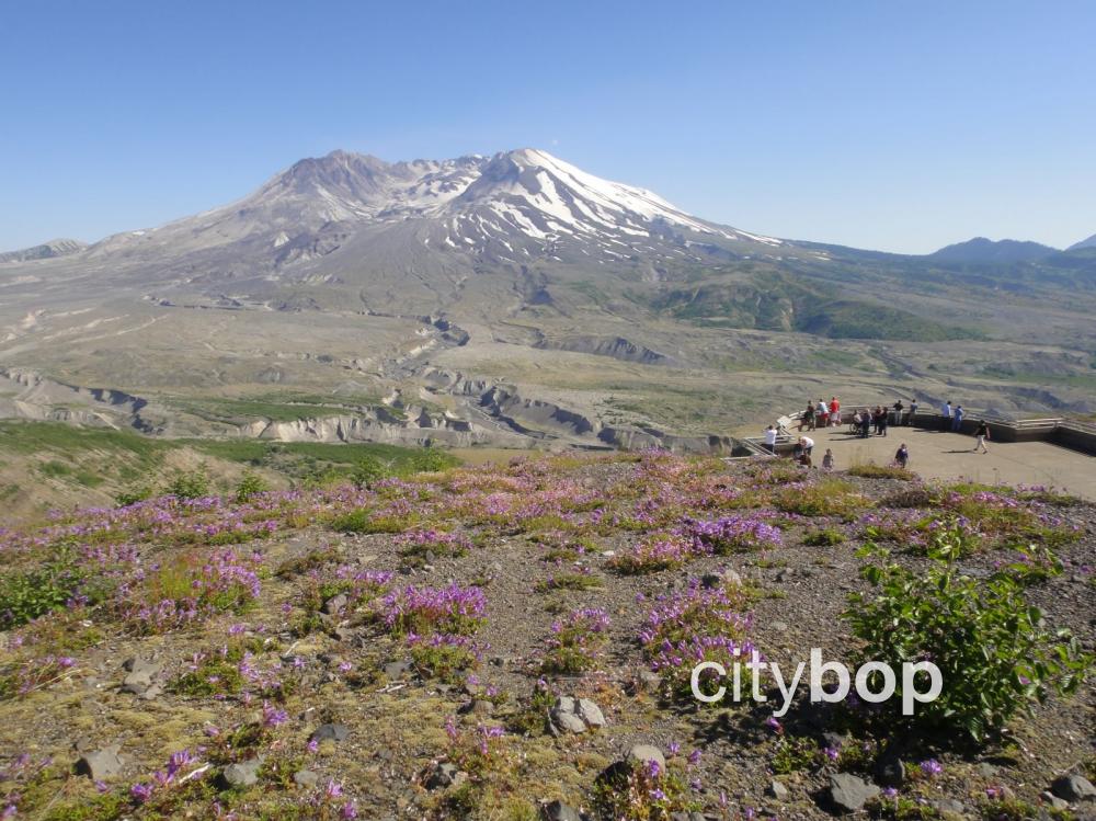
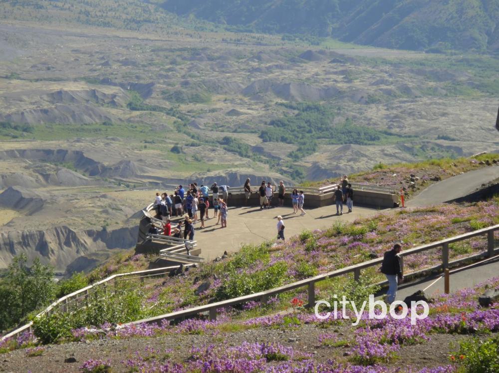
10. Step outside to the main viewing platform at Johnson Ridge Observatory (closed due to landslide)
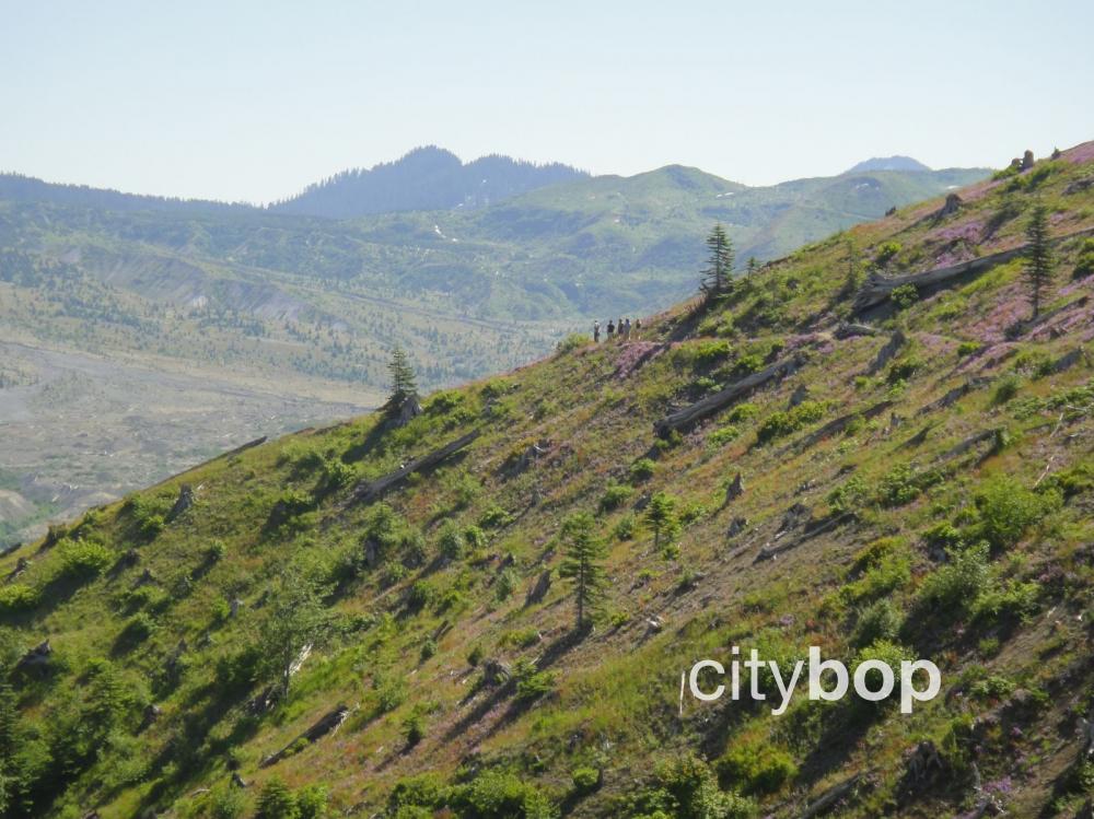
The main viewing platform offers unsurpassed view of Mt Saint Helen's crater from a distance of only 5-miles away. The surrounding landscape provides a sobering reminder of the blast impact, where dead trees were scattered like match-sticks on the barren slopes.
The viewing platform outside the Johnson Ridge Observatory enables you to look right inside the crater floor of Mt Saint Helens. Approximately 70% of the snow, ice and glaciers on Mt Saint Helens were blasted away by the 1980 eruption. Some of the glaciers were 30 feet deep, gone forever.
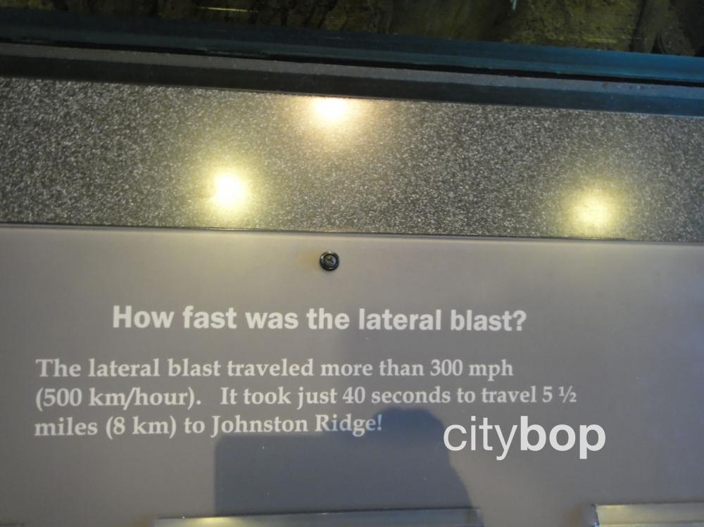
The lateral blast from Mt Saint Helens traveled an astounding 300 miles per hour! It only took 40 seconds to wipe out everything at Johnson Ridge, tossing rock and glacial ice in its direction.
Try and imagine this landscape covered in thick forest before the May 18, 1980 eruption.
Today there are signs of regeneration, but everything still looks very stark.
Can you see the silvery forms of the discarded trees in the blast zone? It's hard to imagine this was once a thick forest.
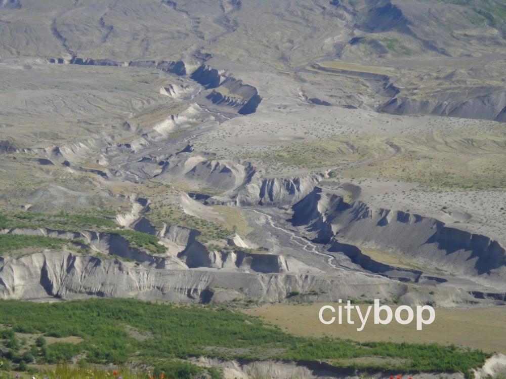
Deep canyons formed, as an avalanche of debris rushed down Mt Saint Helens. This was the largest recorded landslide in history, full of boiling mudflows, volcanic ash, steam water and rock hurtling towards the valley, and choking up the Toutle River with sediment. Everything in its path was swept up.
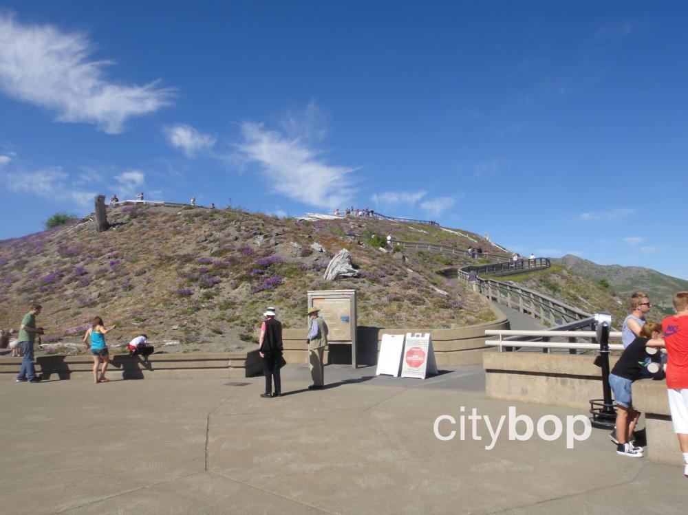
The path outside the Johnson Ridge Observatory, takes you up the hillside for even better views.
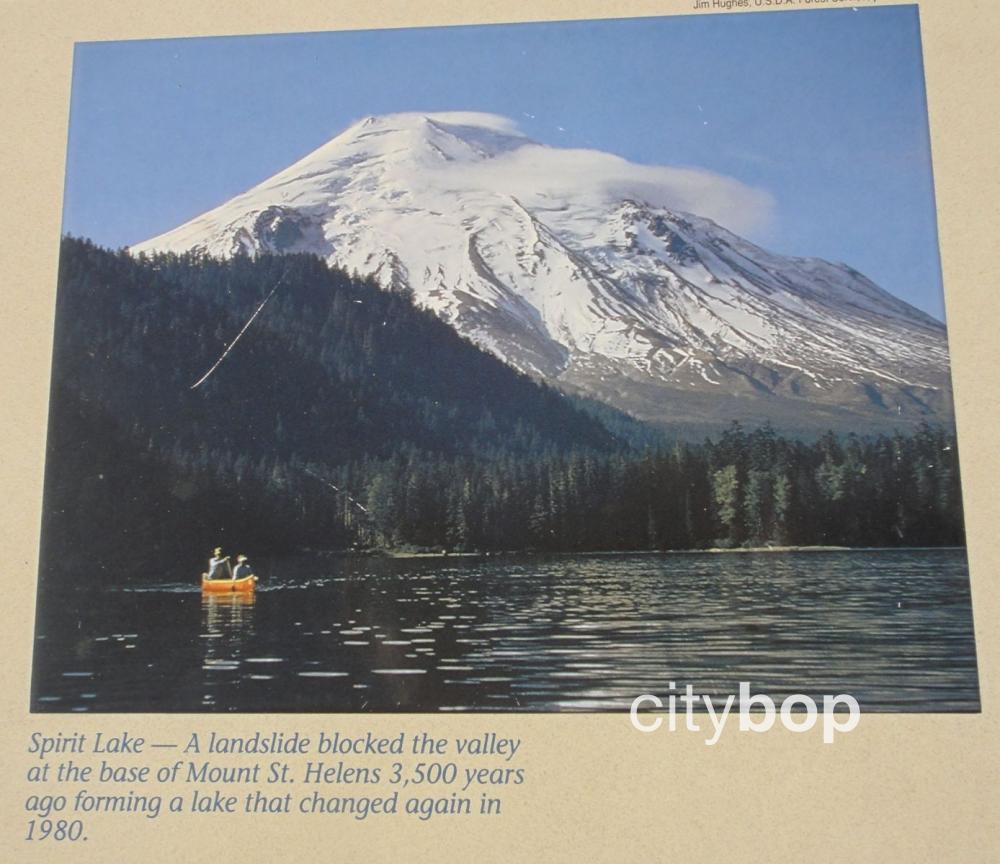
Spirit Lake is roughly 4-miles east of Johnson Ridge Observatory, and was a popular recreation area before the 1980 eruption, home to six camps and multiple lodges that were all destroyed. This is what Mt Saint Helens looked like from Spirit Lake, before the eruption.
The eruption created a dam that raised the water levels of Spirit Lake, and there is concern that an earthquake could breach this dam, devastating downstream communities, and sending a wall of water all the way down to the Columbia River.
Lodging near Mt Saint Helens
There are limited lodging options along SR-504, but these include:
- Eco Park Resort – with cabins, RV, camping, yurts, café and gift shop
- Blue Heron Chateau
Review this attraction